Multi-Sensor Inspection & Intelligence
See What Others
Miss
We work with you to determine the right sensor package and deployment approach for your specific challenge. Aerial or ground-based, surface or subsurface, we turn complex data into actionable intelligence that protects your buildings and your bottom line.
What We Do
Services Built Around Your Challenges
Every service starts with your problem, not our equipment list. We determine the right sensor package and deployment approach, then deliver the analysis and documentation your team needs to make informed decisions.


Our Process
From Raw Data to Real Answers
Every project follows our proven five-step workflow. We start by understanding your challenge and selecting the right sensors and approach, then turn complex multi-sensor data into clear, actionable intelligence your team can use.
Plan
We study your objectives, site conditions, and regulatory requirements to determine the right sensor package and deployment approach before anyone steps on-site.
Capture
We deploy the right combination of sensors from aerial and ground-based platforms, using FAA-compliant, safety-first operations tailored to your project.
Process
Raw data becomes meaningful through photogrammetry, thermal analysis, LiDAR processing, and specialized data workflows.
Visualize
Complex data is translated into clear, visual reports your team can actually use. Interactive 3D models, annotated imagery, and side-by-side comparisons.
Solve
Our analysis identifies the problems, quantifies the risks, and supports your decision-making with data your team can act on.
Our Approach
Precision Capture. Transparent Deliverables.
From routine construction documentation to complex facade captures in high-risk environments, every scope follows a precision-planned methodology. Your stakeholders see the data themselves.
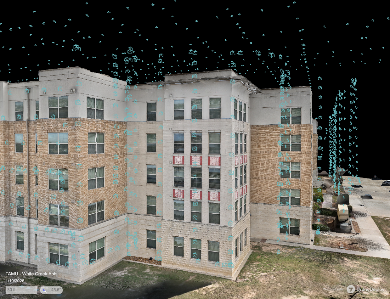
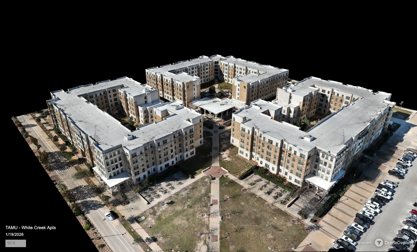
Building Envelope Capture
High-resolution facade and roof documentation with 3D modeling
5 deliverables
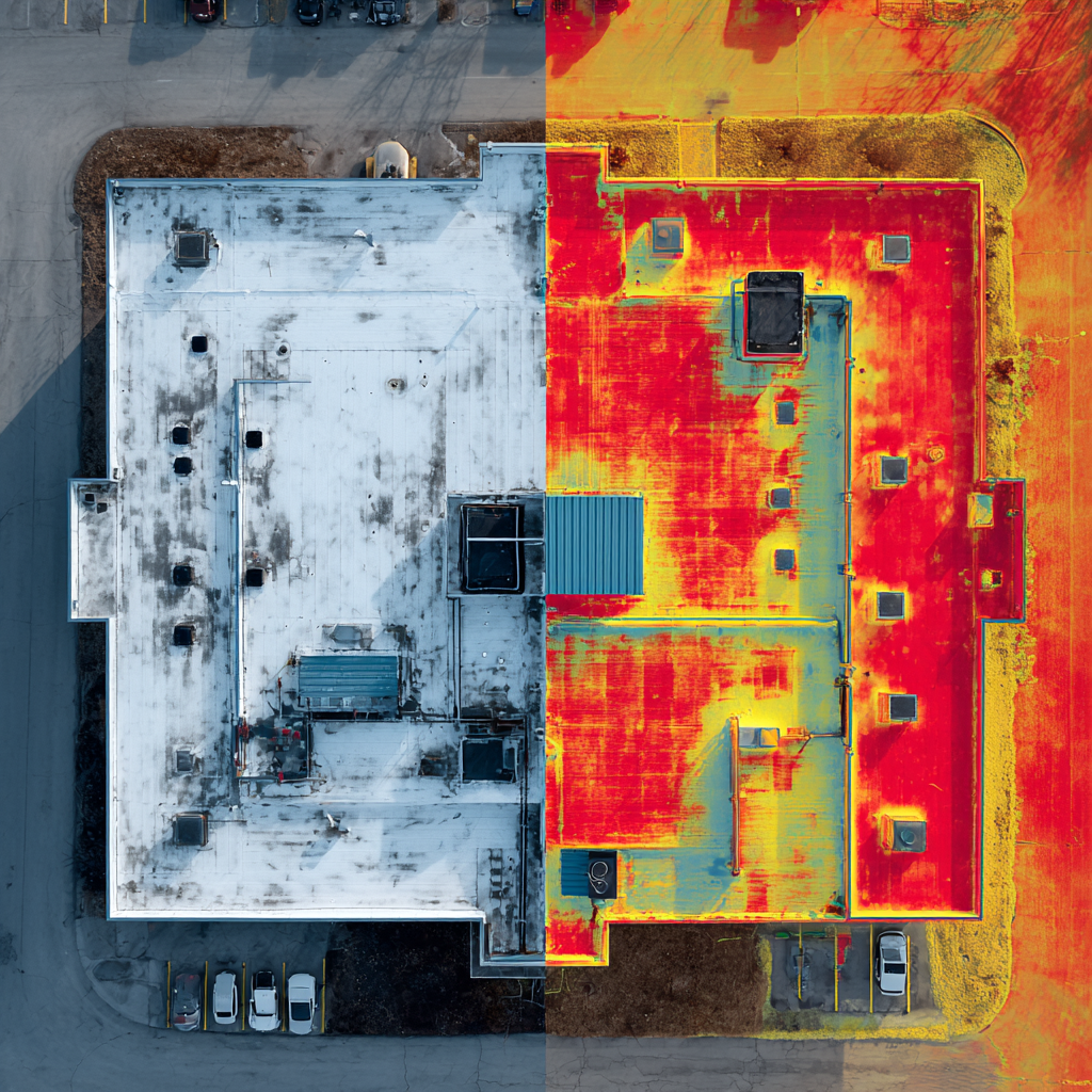
IR Water Intrusion Survey
Radiometric envelope analysis for moisture detection
5 deliverables
Storm Readiness & Damage Assessment
Pre-storm baseline documentation and post-storm damage capture
6 deliverables
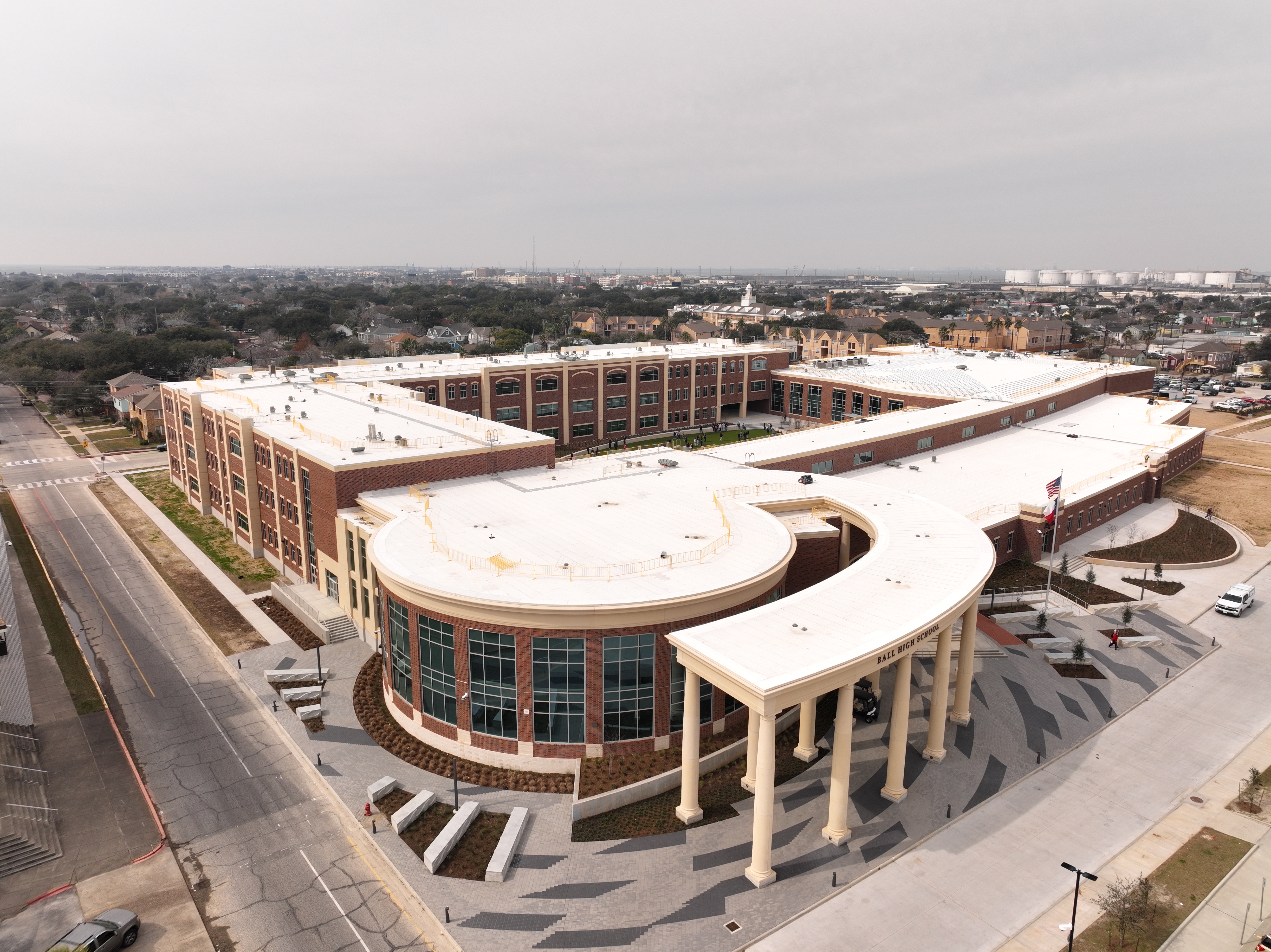
Construction Documentation
Scheduled aerial and ground-based site documentation
6 deliverables
Aerial Intelligence & Mapping
RTK photogrammetry, elevation models, and GIS exports
6 deliverables
Thermal Envelope Analysis
Insulation, air leakage, and thermal bridging identification
5 deliverables
Commercial Missions
Commercial Job Sites
Miles Flown
Safety Incidents
Why Trust Us
Credentials That Back Up the Work
Professional certifications, proper insurance, and a safety-first mindset — the foundation every client deserves.
FAA Part 107 Certified
Fully licensed by the Federal Aviation Administration for commercial drone operations, ensuring legal compliance on every flight.
Certified sUAS Thermographer
Specialized certification in aerial thermal imaging — interpreting radiometric data accurately, not just capturing pretty heat maps.
Fully Insured
Comprehensive general liability and hull insurance protects your property and our operations on every project.
Safety-First Operations
Rigorous pre-flight checklists, risk assessments, and site safety plans for every mission — because professionalism starts on the ground.
Trusted By
Results
Real Projects. Real Impact.
Every project tells a story of problems found, risks quantified, and decisions supported. Here's a look at what we deliver.
Ready to Get Started?
Let's Find What You've Been Missing
Whether you need a building envelope assessment, thermal survey, or construction documentation — tell us about your project and we'll show you exactly how we can help.
No pressure. No obligation. Just a conversation about your building.